Geomorphological Surveys of Successive Landslide Dams
less than 1 minute read
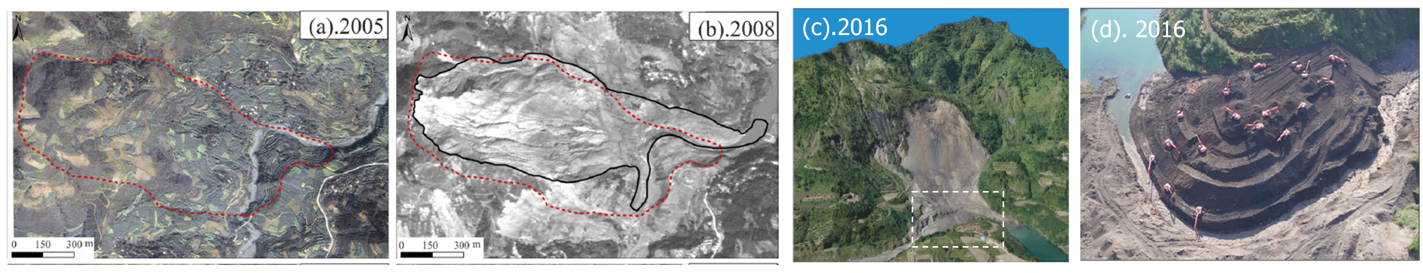
Earthquakes can not only cause immediate slope failure but also affect slope stability and landscape evolution in the short and long terms. Through the extensive field surveys in the earthquake-impacted area, I found an interesting near-fault slope unit where at least three landslide events occurred and dammed the river in the past. From the hazard assessment and prevention perspective, it is important to explore landslide hazard management at such successive sliding and dam sites. I collected multi-temporal remote sensing images and terrain data through unmanned aerial vehicle (UAV) surveys and conducted geomorphological and geological surveys. I concluded that this site is a good example of multiple reactivations of a prehistorical giant landslide under different triggering conditions: a reactivation of an older landslide during a strong earthquake, and a second reactivation during a rainfall event several years later. Meanwhile, I proposed a generalized framework for assessing landslide dam cascading hazards, including landslide volume estimation, empirical landslide dam stability evaluation, GIS-based barrier lake volume estimation, and dam-breach flooding parameter estimation.