Open-source Geospatial Liquefaction Database and Associated Tools
less than 1 minute read
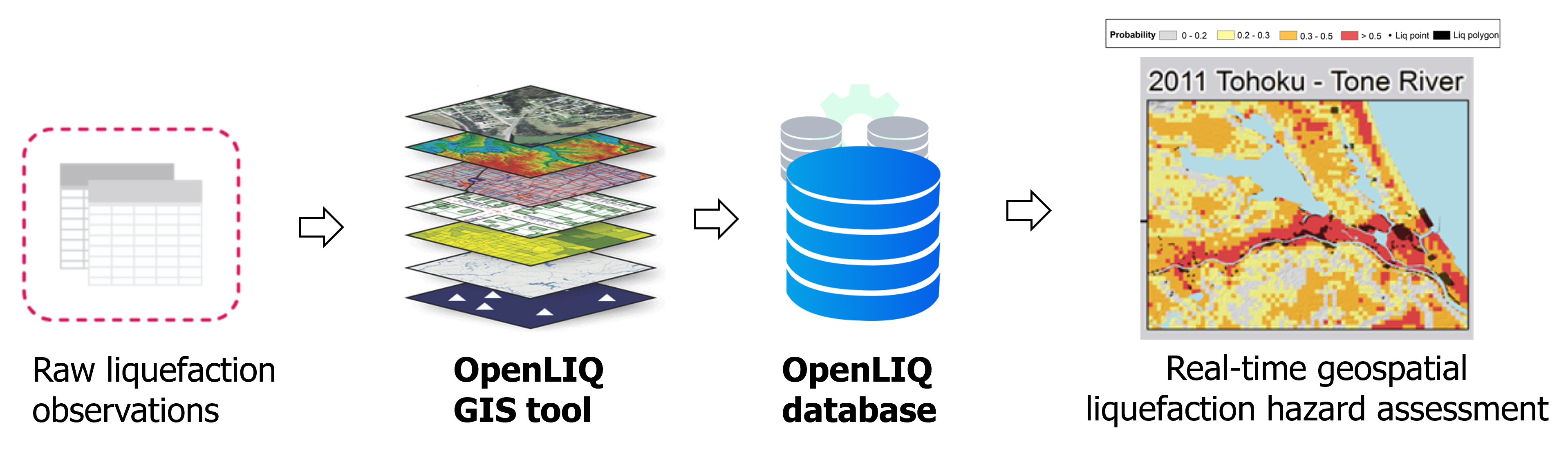
OpenLIQ is a geospatial database of global seismic liquefaction hazards. The OpenLIQ database currently includes ~290,000 samples (~63% of them are liquefaction points) and 19 geospatial predictors for 51 worldwide earthquakes. In addition, the OpenLIQ project includes a semi-automatic GIS workflow that can automatically conduct geospatial sampling of liquefaction and non- liquefaction points from liquefaction inventories (georeferenced liquefaction points and/or polygons), extract candidate geospatial predictors, and generate maps for quality check and visualization purposes. This workflow only requires limited manual inputs (e.g., incomplete or complete liquefaction inventory, and raster data for geospatial predictors). The GIS workflow will be used to process new liquefaction inventories, and the OpenLIQ database will be used to advance applications of different machine learning and uncertainty quantification methods in global geospatial liquefaction modeling.