Research
Our research advances the understanding and modeling of complex geosystems-hazard-infrastructure interactions by integrating field observations, remote sensing, near-surface geophysics, process-based and data-driven modeling.
Landslides and Slope Stability
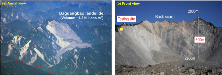
Our landslide research connects slope processes with hazard assessment across local to regional scales. Published work spans coseismic landslide inventories, rock-avalanche mobility, landslide dams, progressive slope deformation, remote-sensing-based early detection, dynamic susceptibility mapping, and uncertainty-aware stability and reliability analysis.
Earthquake Ground Motions
Our earthquake research examines how source, propagation path, subsurface geology, topography, and basin structure shape ground shaking. Published studies develop geospatial site-amplification models, measures of site-response complexity, HVSR- and Vs30-informed site terms, basin-effect assessments, and machine-learning ground-motion models for spatially variable and nonergodic applications.
Liquefaction Hazard Assessment
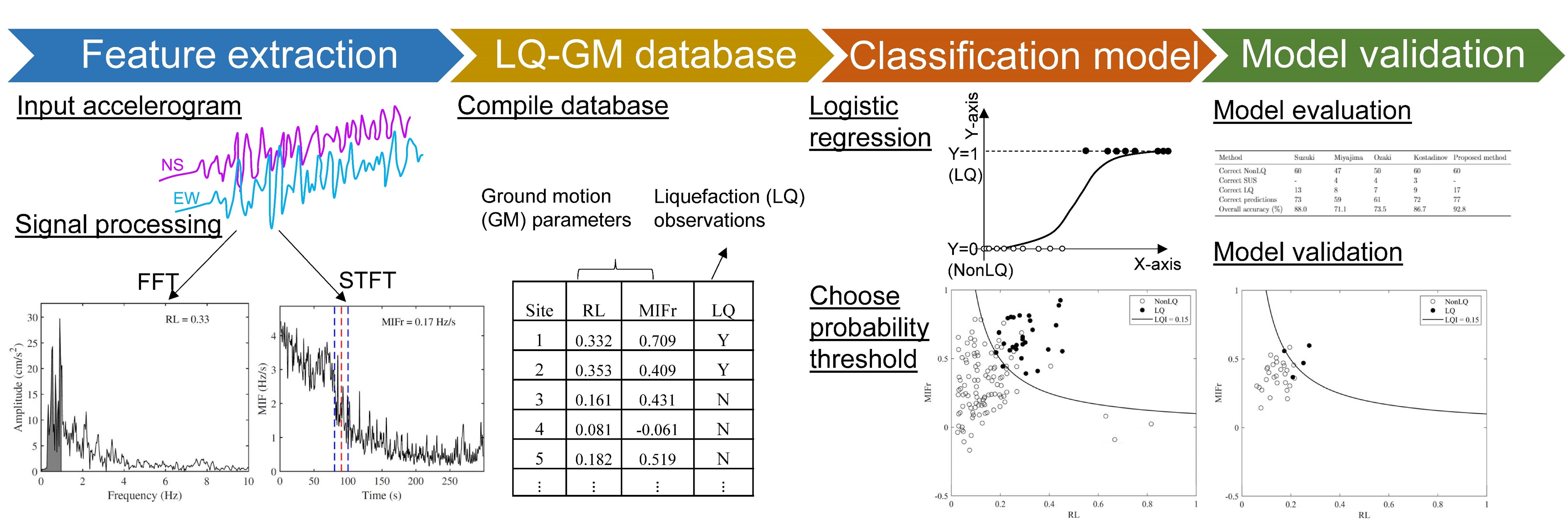
We develop methods to assess liquefaction occurrence and consequences before and after earthquakes. Research spans regional susceptibility and triggering models, accelerogram-based detection, lateral spreading and ground deformation, liquefaction-affected ground motions, and uncertainty-aware approaches that support rapid hazard assessment and infrastructure decisions.
Coastal Hazards and Resilience
We examine how hurricanes and other coastal storms reshape beaches, dunes, barrier islands, inlets, and adjacent infrastructure. By combining repeated LiDAR and satellite observations, field reconnaissance, geophysical and geotechnical measurements, and process-informed analytics, we seek to explain spatially variable impacts and improve coastal-hazard and resilience assessment.
Sinkhole Science and Hazards
Coming soon.
Ecosystem Sustainability
Coming soon.